 vesseltracker.com
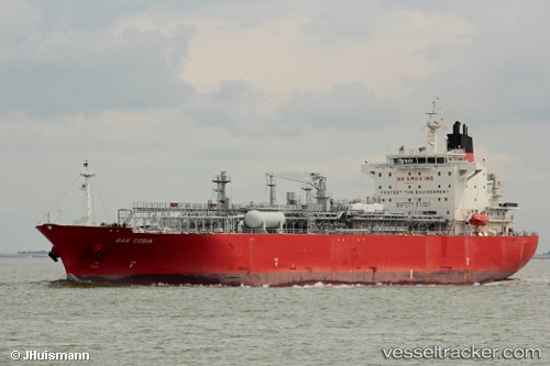
Vessel OCEANIC BREEZE IMO: 9451991, MMSI: 636023108 Lpg Tanker
UTC, 36.18500, 21.70333, course: -1, speed: 9
UTC, 36.17166, 22.11056, course: 87, speed: 1.4
2026-01-27 08:28:36 UTC, 36.17898, 22.15408, course: 41, speed: 1
Live AIS position:
UTC. 30 nm S of Areópolis),
updated 2026-01-27 08:28:36 UTC.
Find the position of the vessel OCEANIC BREEZE on the map. The latter are known coordinates and path.
marine traffic ship tracker show on live map
The current position of vessel OCEANIC BREEZE is 36.17898 lat / 22.15408 lng. Updated: 2026-01-27 08:28:36 UTCCurrently sailing under the flag of Liberia
OCEANIC BREEZE built in 2011 year
Deadweight:
26416 tDetails:
Last coordinates of the vessel:
UTC, 36.19167, 21.46333, course: -1, speed: 9UTC, 36.18500, 21.70333, course: -1, speed: 9
UTC, 36.17166, 22.11056, course: 87, speed: 1.4
2026-01-27 08:28:36 UTC, 36.17898, 22.15408, course: 41, speed: 1